
[Click on photos to enlarge them]
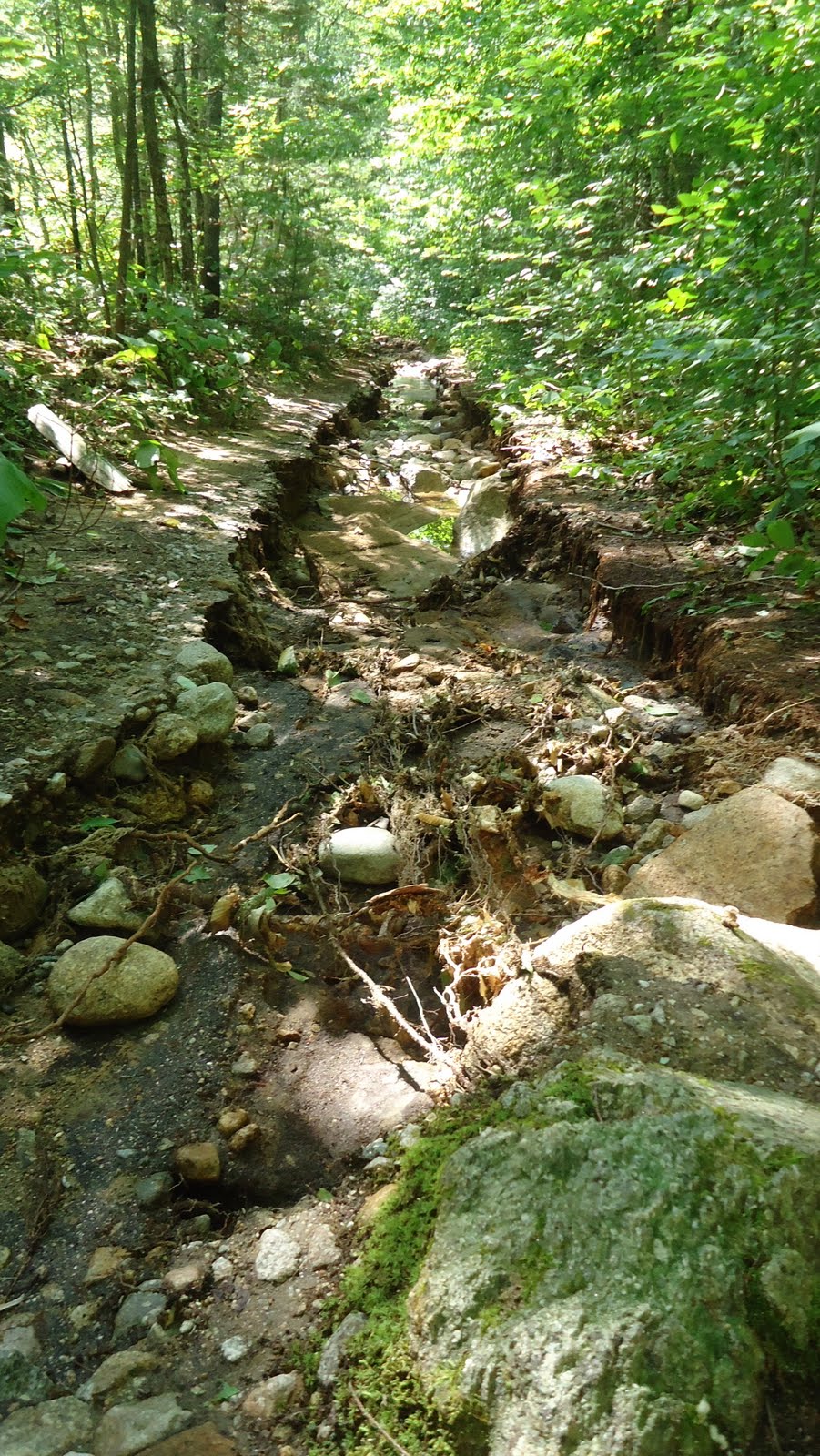
The entire length of the Greeley Ponds Trail has been devastated by Hurricane Irene, but no place more so than the section before the Scaur Trail junction [see below], where the Mad River, having its course thrown off-stream by washed-out rocks and tree-debris, is draining into the Greeley Ponds Trail in several places, so that it is two or three feet deep in places, resembling a mountain brook, rather than our beloved hiking and X-C ski trail!
The following is a photojournal of sorts by Dan Newton, taken the week after the storm, while out assessing the trail with members of the White Mountain National Forest, the week after the big storm. At present, and for the foreseeable future, the trail is closed.


Beyond the worst of the flooding, the trail has been gutted by the raging torrent, so that its footbed is a rumble of rocks with no dirt. Except for the flooded-out sections before the Scaur junction, the rest of the entire trail looks more or less like the pictures below...

The Knight Bridge weathered the storm with no damage, but the bridge beyond it, between the Flume Brook Trailhead and the Kancamagus Brook Ski Trailhead, was partially destroyed. It's a steel-girder bridge, but it's jointed in the middle. The Flume Brook ripped it apart and washed one half of the bridge downstream, but the other half remains standing, as if oblivious to the destruction around it. The Flume brook has been redirected by the chaos; and so, the bridgehalf that remains spans a now dry brookbed.

The abutment remaining on the nearside of the bridge looks lonely and a little confused as it gazes out across the dry rocks...

Above the bridge, or what's left of it, the trees and rocks have been washed into a moutainous ridge of debris that redirects the brook, so that it flows over the topsoil above where the trail crosses the bridge.


At this point in my investigations, I left my companions, Jenny Burnett of the WMNF and four fireman from Maine, hired to help forge a path through the debris, and headed for the Flume Brook Trail, which I suspected was significantly affected. The report from Jenny is that the rest of Greeley Ponds Trail is "horror-ific." Rough estimates suspect that the trail will be closed for at least a year, and there has been talk of re-routing the trail... This is really hearsay at this point; so, stay tuned...
Meanwhile, I headed up the Flume Brook Trail. At the section which was always sort of "in" the brook for a few steps, the "few steps" are now more like 50 yards of trail wiped out by the brook. In the first picture below, the trail is at the upper righthand corner; and in the second photo, looking downtrail, you can see the trail on the lower left of the frame, and the rest of it--- gone.


After another short washout and a generally gutted-out trail, the pool in the flume at the trail terminus is guarded by a massive pile of washdown...

...and, the little round pool has been redesigned. The water obliterated the trail along the rock wall, and the HUGE stones we used to sit on, have been repositioned, so that the pool is now rectangular, and deeper. It's quite nice actually, a silver lining of sorts, after all the devastation...
